The St. Johns River rose past its record above Lake Harney early Sunday, Nov. 22, and the flood is still moving downstream. National Weather Service forecasts show the river rising at Sanford, DeLand and Astor through Thanksgiving week, with every gauge from Cocoa to Astor in or near major flood stage.
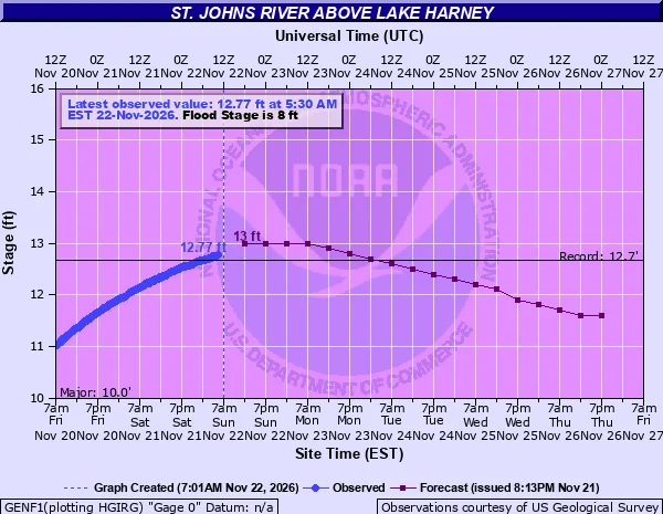
Above Lake Harney, near Geneva, the river reached 12.77 feet at 5:30 a.m. Eastern, past the record of 12.67 feet set in October 2022. Near Cocoa, where the river first broke its record on Thursday, the federal river gauge west of the city read 18.7 feet early Sunday. That is more than a foot above the highest crest the gauge lists, 17.55 feet in October 1953.
Above record at Lake Harney and Cocoa
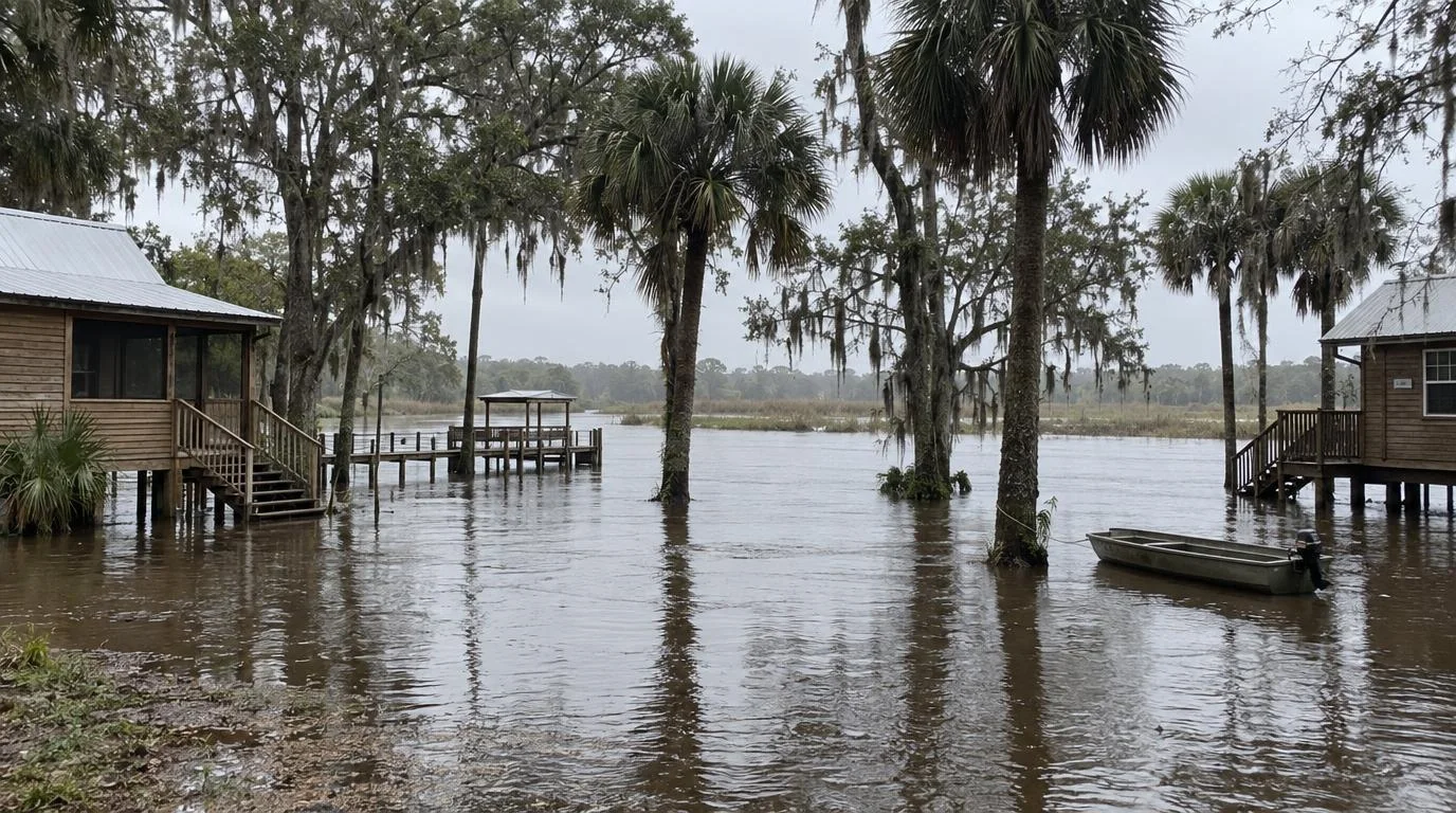
The NWS Melbourne office says extreme rain over the headwaters pushed the river near Cocoa well above its previous record, and it expects the level to hold near 18.8 feet into the middle of the week. At that height, the office's flood warning says, water enters homes along the river around Lake Poinsett and low-lying homes in Rockledge's Silver Pines subdivision and Cocoa's Shakespeare Park area. Providence Road becomes impassable, cutting off homes around Mullet Lane and Bass Road.
Above Lake Harney, forecasters expect a crest near 13 feet on Sunday, then a slow decline that keeps the river in major flood stage. The warning says water covers State Road 46 near Jungle Road and Prevatt Road at these levels, and standing water on side roads near the river can be more than 3 feet deep. The Florida Department of Transportation has closed SR 46 at the river in Seminole and Volusia counties, according to Seminole County's flood page.
The crest moves north through Thanksgiving week
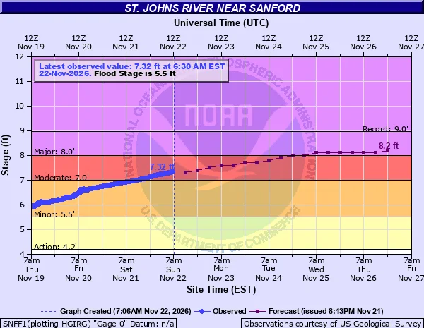
The St. Johns flows north. Water that fell over Brevard County weeks ago is still arriving downstream. Volusia County says runoff from the early November rain was already raising the river there before last week's storms added more.
| Gauge | Sunday morning | Major flood stage | Forecast | Record |
|---|---|---|---|---|
| Near Cocoa | 18.7 ft | 17 ft | Near 18.8 ft into midweek | 17.55 ft (1953) |
| Above Lake Harney | 12.8 ft | 10 ft | Crest near 13 ft Sunday | 12.67 ft (2022) |
| Near Sanford | 7.3 ft | 8 ft | 8.2 ft by Thanksgiving | 8.96 ft (2022) |
| Near DeLand | 5.25 ft | 5.3 ft | 6.0 ft by Wednesday | 6.33 ft (2022) |
| Astor | 4.1 ft | 4 ft | 4.3 ft midweek | 4.81 ft (2024) |
The lower three gauges are not forecast to reach their records, but each warning allows for more rises after the forecast period. Near Sanford, flooding at 8 feet becomes more serious for low-lying buildings and marinas around Sanford, Enterprise and Lake Monroe. The DeLand warning says major flooding reaches many structures and marinas and the Hontoon Island area. At Astor, the warning describes long-lasting flooding with water rescues and evacuations needed, and 2 to 3 feet of water in many low-lying areas near the river.
Seminole County says river levels are expected to stay high well into December before they slowly go down.
Sandbags and closures
Volusia County is opening a new self-service sandbag site at Ed Stone Park, 2990 W. State Road 44 in DeLand, from 10 a.m. to 5 p.m. Sunday and 8 a.m. to 5 p.m. daily starting Monday. Sand and bags are free. Residents bring their own shovel and gloves. Sites also remain open at Volusia County Fire Rescue Station 36 in Osteen and at Lake County Fire Rescue Station 10 in Astor, which is open around the clock.
Seminole County has self-service sandbags at the Old Geneva Volunteer Fire Station, 217 2nd St., and Lake Monroe Wayside Park, 4150 US-17 in Sanford, from 7 a.m. to 7 p.m. Its list of flooded county roads includes Lake Harney Road, North Jungle Road, Mullet Lake Park Road and several streets in St. Johns Estates, and parks and boat ramps along the river are closed.
Both counties are under local states of emergency. Edit USA reported the record near Cocoa on Nov. 19 and the earlier flood warnings around Lake Harney, Sanford and DeLand on Nov. 18.