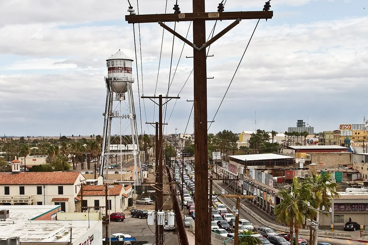
A magnitude 4.7 earthquake struck just south of the California border at 10:27 a.m. Pacific on Tuesday, and the federal warning system sent an alert to phones. It was felt from Yuma to San Diego. The quake was centered 9.5 kilometers (5.9 miles) north of Delta, Baja California, about 36 kilometers (22 miles) southeast of Mexicali, at a depth of 15.8 kilometers, according to the U.S. Geological Survey event page.
Mexico's National Seismological Service measured it at magnitude 4.6, 12 kilometers northwest of Guadalupe Victoria, at 14 kilometers deep. Neither agency's record listed damage or injuries as of 11 a.m. Pacific.
Why phones got an alert for a 4.7
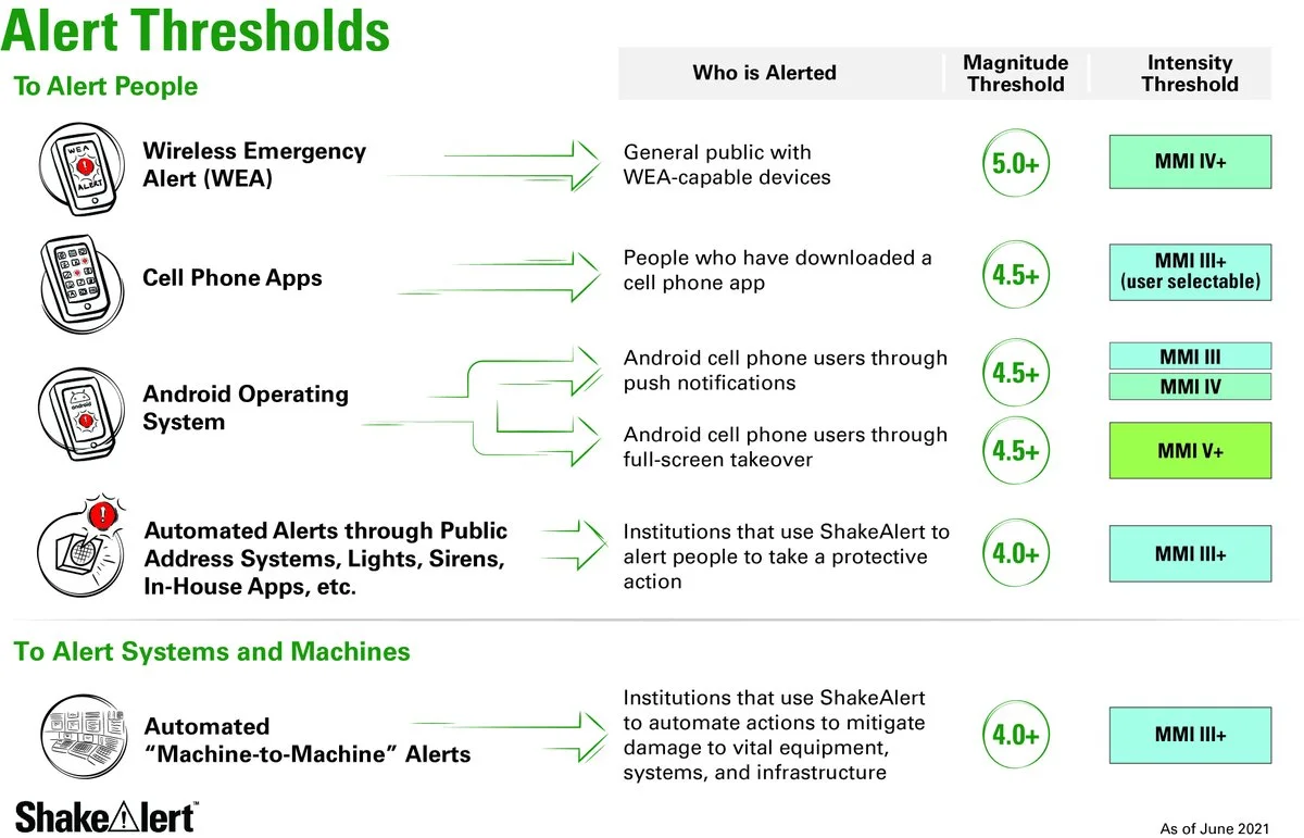
The warning came from ShakeAlert, the West Coast early warning system USGS runs, and its post-alert summary shows why a 4.7 set it off. ShakeAlert has to estimate a quake's size in the first seconds, from a handful of stations, before the shaking spreads.
Its first message went out 9.3 seconds after the quake began, based on five stations, and estimated magnitude 5.2. At 14.4 seconds, with 12 stations reporting, the estimate peaked at 5.4. By 28 seconds, with 62 stations feeding it, ShakeAlert's own figure was down to 5.0, and the magnitude seismologists settled on after review was lower still, at 4.7.
Under the rule printed on that summary, Wireless Emergency Alerts go to the area expected to feel intensity IV shaking or stronger whenever ShakeAlert's peak estimate reaches magnitude 5.0. This one peaked at 5.4, so the alert went out over WEA, the U.S. phone alert channel that also carries Amber Alerts. No seismic station sat within 10 kilometers of the epicenter, and the shaking had already spread about 29 kilometers (18 miles) by the time the first message was released.
Phones can also warn people through other routes. ShakeAlert's published alert thresholds, in a USGS chart dated June 2021, start lower for its cell phone apps and for Android's built-in alerts, at magnitude 4.5.
Where it was felt
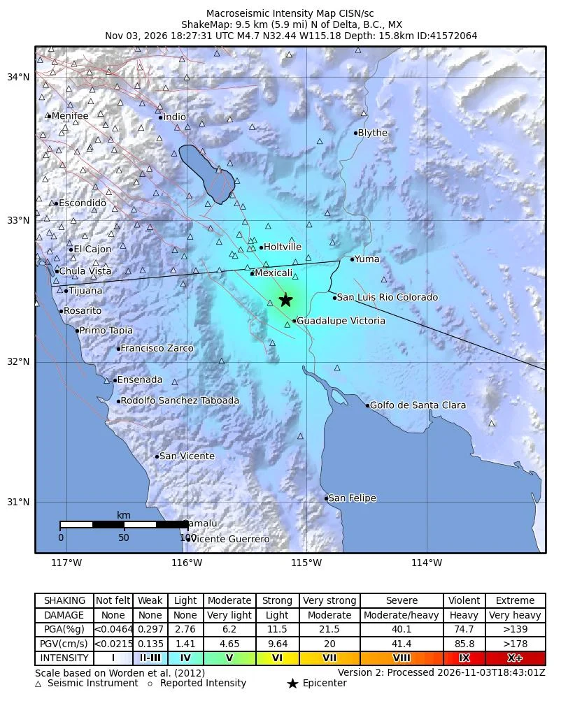
People sent "Did You Feel It?" reports to USGS from Yuma, Arizona, from Calipatria in the Imperial Valley, and from San Diego and Spring Valley more than 180 kilometers away. The strongest reports reached 4.5 on the intensity scale, between light and moderate. San Diego's were weak.
A smaller quake came first. USGS recorded a magnitude 3.6 at 10:17 a.m., ten minutes earlier and in nearly the same spot, and Mexico's service measured that one at 4.1. At least four other quakes of magnitude 2.5 or more have hit within 60 kilometers since late Sunday night.
What the aftershock forecast says
USGS posted an aftershock forecast on the event page about 10 minutes after the quake. Over the next week, it put the chance of another quake of magnitude 3 or larger at 68 percent, magnitude 4 or larger at 19 percent, and magnitude 5 or larger at 2.5 percent, while a magnitude 6 or larger came in at 0.26 percent. For the next 24 hours alone, the odds of a 5 or larger were 1.5 percent.
Those numbers change as the sequence develops, and USGS updates the forecast on the event page. If the ground shakes again, ShakeAlert's advice is to drop, cover and hold on.