A strong El Niño tilts the odds for the coming winter toward a wet season in the South and along the East Coast and a milder one across the northern states, according to the winter outlook NOAA's Climate Prediction Center issued on Thursday, Nov. 19.
The outlook covers December through February. It gives only the chances that a region ends up warmer, colder, wetter or drier than normal over those three months combined, so it says nothing about a single storm or a cold snap in any given week.
Where a wet winter is most likely
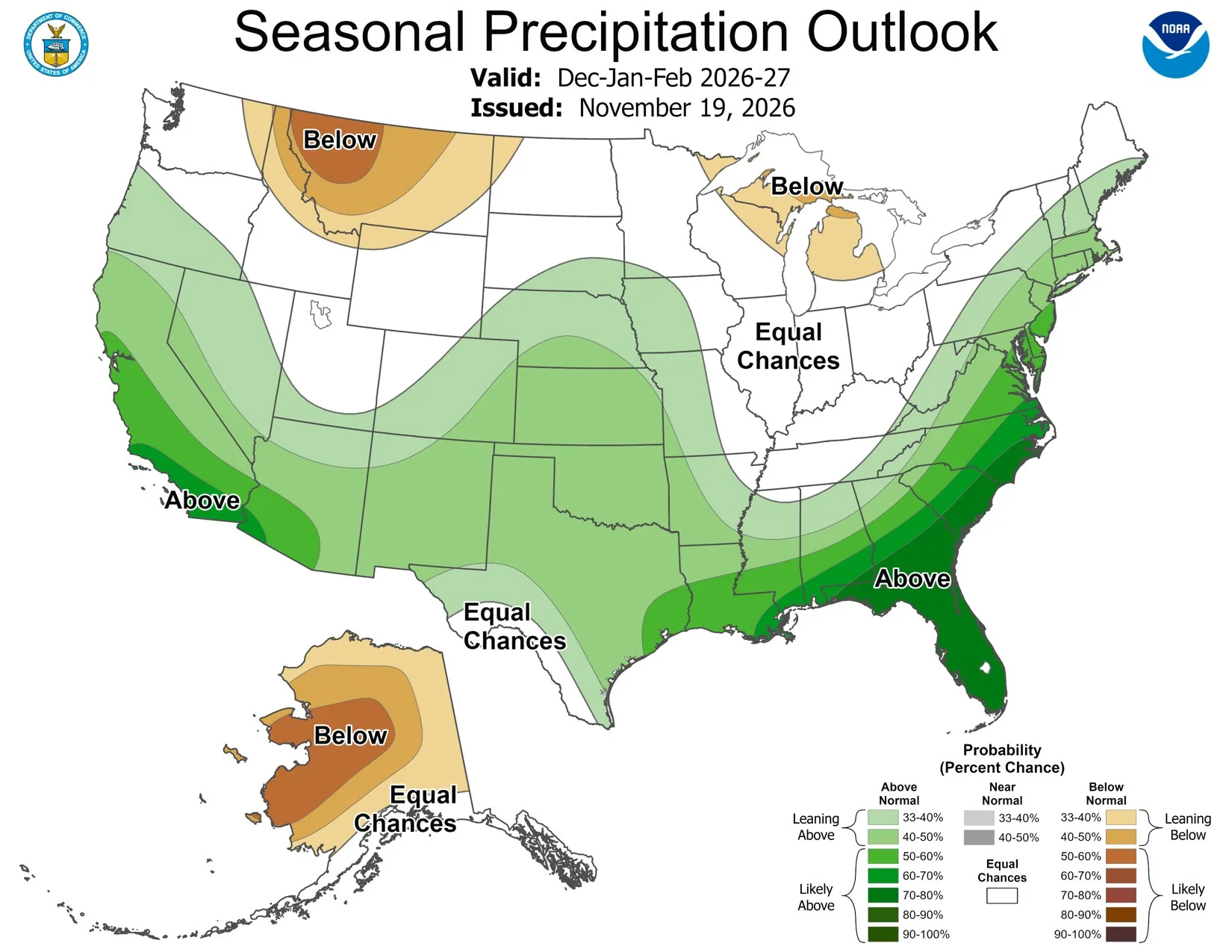
Forecasters wrote that they have more confidence in the precipitation outlook than the temperature one, because strong El Niño winters have a reliable wet pattern. An active southern storm track is expected to carry extra moisture from California across the Southwest and the southern Plains to the Gulf Coast and much of the East Coast.
| Region | Chance of above-normal precipitation |
|---|---|
| Florida, southern Georgia, coastal Carolinas | More than 70% |
| Southern California, southwestern Arizona | More than 60% |
| Southwestern Oregon, the rest of California, the Southwest, central and southern Plains, Gulf Coast, much of the East Coast | More than 40% |
The center raised the odds for California, the desert Southwest and the East Coast compared with its October outlook. It also expects the wet pattern in the Southeast to peak late in the winter and to linger in California and parts of the South into spring.
Where it could run warm or dry
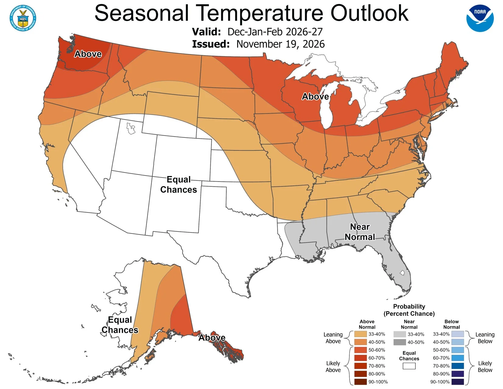
The northern two-thirds of the Lower 48 leans warmer than normal. The odds top 50% across the Northeast, the Great Lakes, the Upper Mississippi Valley and the Pacific Northwest, and exceed 60% from northwestern Oregon and Washington north into southeastern Alaska.
The northern Rockies, the Northern Plains, parts of the Great Lakes and much of mainland Alaska lean drier than normal, because El Niño tends to push the storm track south.
Florida and the area from southeastern Louisiana to southern Georgia are the main exception on temperature. Forecasters favor near-normal readings there, based on how the 2023-24 and 1997-98 El Niño winters turned out. The Southwest and southern Plains are marked as equal chances, because recent strong El Niños produced very different temperatures there.
What could change the picture
The biggest unknown is the amount of high-latitude blocking that sets in, which can send Arctic air south. The North Atlantic Oscillation, one of the pressure patterns behind it, turned negative in early November, and the U.S. and European ensemble forecasts favor it staying negative into December. That would tend to mean colder weather in the Southeast. The center notes that the 2009-10 El Niño winter, when a strongly negative Arctic Oscillation brought widespread cold to the Plains and Southeast, can't be ruled out, though it calls that outcome the least likely of recent strong events.
The El Niño itself has a greater than 79% chance of staying strong to very strong through January to March, according to the center's Nov. 12 El Niño update. Edit USA reported on that update last week. The next seasonal outlook is due Dec. 17.